29th Apr, 2020 11:00
Fine Photographica

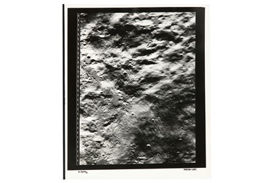
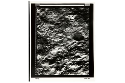
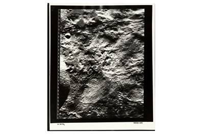
The Most Comprehensive Map of the Lunar Crater Copernicus
The Most Comprehensive Map of the Lunar Crater Copernicus
LUNAR ORBITER V, August 1967, Large format vintage silver gelatin mosaic prints (3), image size 520mm x 410mm, sheet size, 610mm x 510mm, mapping the eastern rim of the Copernicus Crater, numbered NASA-LRC V157 H1 to V157 H3
The Lunar Orbiter program was a series of unmanned missions to help with the selection of landing sites for the later Apollo missions, they provided the first photographic maps from a lunar orbit. Taking its name from the great astronomer Nicolaus Copernicus (1473-1543) the 93km crater is one of the Moon's most prominent feeatures and is easily visible with binoculars. Formed over 1 billion years ago by an impact from a meteor, the crater features a central complex of peaks surrounded by smooth flats bordered by a crater wall 3.8km high. The Lunar Orbiter photographs were transmitted to Earth as analogue data after on board scanning of the original film into a series of strips. The data was written onto magnetic tape and also to film. The film data was then used to create hand-made mosaic composite images on Earth by layering these strips side by side.
Sold for £500
Includes Buyer's Premium
Do you have an item similar to the item above? If so please click the link below to submit a free online valuation request through our website.

