24th May, 2023 11:00
Books & Works on Paper

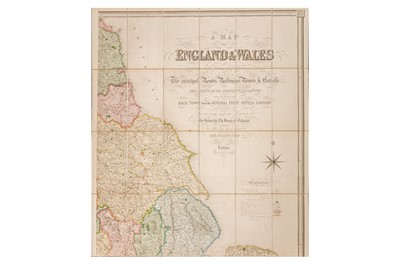
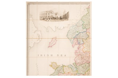
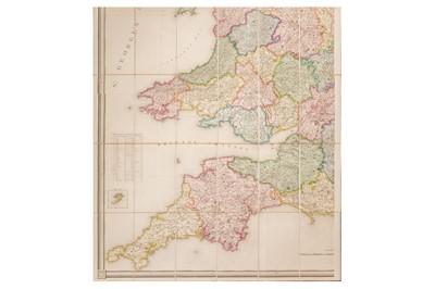
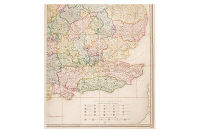
Lewis (S. & Co., publisher) A Map of England and Wales… Showing the Principal Roads, Railways…
Lewis (S. & Co., publisher)
A Map of England and Wales… Showing the Principal Roads, Railways…, 1839, very large fully hand-coloured engraved map in 4 sections, overall 70 x 83ins, 1800 × 2100mm - (each sheet 35 × 41.Sin., 900 x 1055mm) - dissected and mounted on linen, the whole folding into an original green cloth slipcase (corners worn.) Includes large calligraphic title, explanation, large engraved view of the General Post Office, table of Dioceses with crests, table of distances by sea, all within a "piano-key" frame.
Sold for £62
Includes Buyer's Premium
Do you have an item similar to the item above? If so please click the link below to submit a free online valuation request through our website.

