27th Jan, 2022 11:00
Books & Works on Paper including Contents from the Estate of Paul Gallico

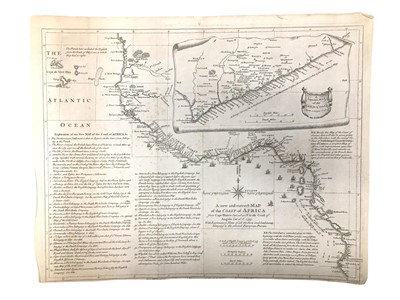
Seale (R.W): Africa
Seale (R.W.)
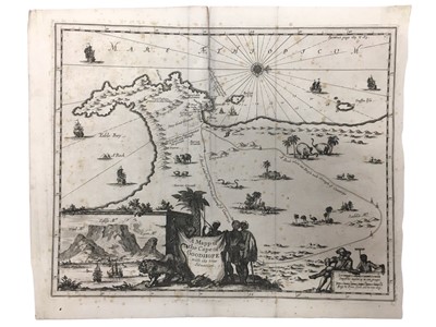
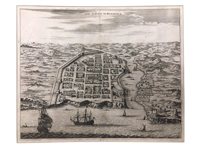
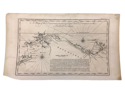
A new and correct Map of the Coast of Africa, From Cape Blanco…to the Coast of Angola…With Explanatory Notes of All the Forts and Settlements belonging to the several European Powers, folds, cropped close at bottom margin affecting imprint, 405x 510mm, Printed for J. & P. Knapton, [1753]; Ogilby (John) Old Santo Domingo; Urbs Domingo in Hispaniola, first English edition after Arnoldus Montanus's De Nieuwe en Onbekende Weereld, 410 x 455mm, [Amsterdam, 1671]; Angra op Tercera, slightly creased, fold strengthened on reverse, 395 x 460 mm, [Amsterdam, 1671]; Ostium Flumines Paraybae, fold strengthened on reverse, 405 x 485mm, [Amsterdam, 1671]; Pagus Hispanorum in Florida, engraving of the first Spanish settlement in North America, 400 x 445mm, [Amsterdam, 1671]; Harris (John) A Map of the Discoveries made by Capt. Willm. Dampier in the Roebuck in 1699, from the 'Navigantium atque Itinerantium bibliotheca. Or, a Complete Collection of Voyages and Travels', 240 x 400mm, [T. Osborne,1764] (6)
Sold for £250
Includes Buyer's Premium
Do you have an item similar to the item above? If so please click the link below to submit a free online valuation request through our website.

