30th Jun, 2021 11:00
Fine Books & Works on Paper

London & Middlesex.- Maps
London & Middlesex.- Maps
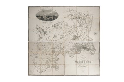
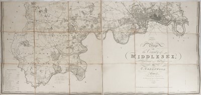
Greenwood (Christopher) Map of the County of Middlesex, large engraved folding map, with view of London skyline from "Buckingham House", dissected and laid onto linen in four parts, with marbled paper covers and contemporary manuscript labels, contemporary annotations, some browning to edges, c.126 x 132cm, Pringle & Greenwood, 1819; Stanford (Edward) Library Map of London and its Suburbs, 3 sections only (of 4, lacking South East), dissected and laid onto linen, printed labels, morocco case, worn, James Wyld, 1886; with 3 others (5)
Do you have an item similar to the item above? If so please click the link below to submit a free online valuation request through our website.

