28th Apr, 2022 10:00
Fine Books & Works on Paper

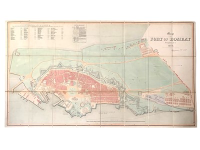
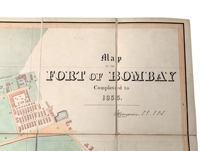
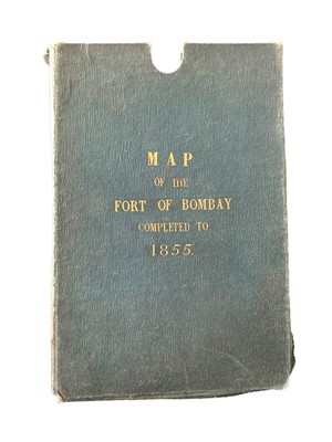
Conybeare (Henry) Map of the Fort of Bombay. Completed to 1855
Conybeare (Henry)
Map of the Fort of Bombay. Completed to 1855, showing street names, principal buildings, railways, military, and dockyard installations, original hand-coloured folding map laid-down on linen, original cloth slipcase lettered in gilt, 131 x 75.5cm, Vacher & Sons, London [1855]
***Only one copy was found at the Universities of Oxford libraries, c. 250 copies were printed and supplied to Government departments and sold to the public.
Sold for £8,750
Includes Buyer's Premium
Do you have an item similar to the item above? If so please click the link below to submit a free online valuation request through our website.

