2nd Dec, 2020 14:00
A Middle Eastern Journey | Live Online

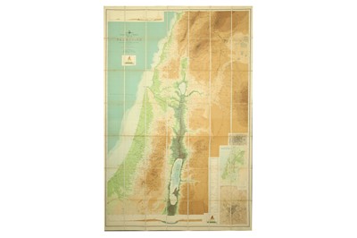
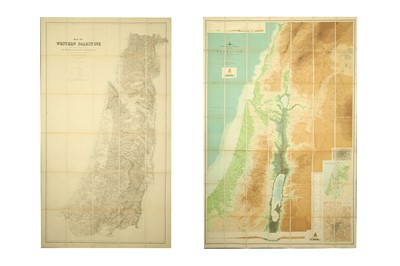
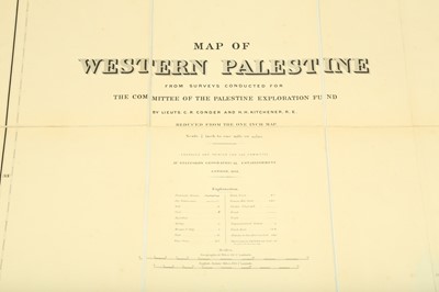
MAP OF WESTERN PALESTINE, BY C.R. CONDER R.E. KITCHNER
1901
MAP OF WESTERN PALESTINE, BY C.R. CONDER R.E. KITCHNER, 1901
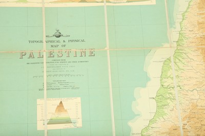
From Surveys Conducted By The Palestine Exploration Fund By Lieuts, C.R. Conder and H. H. Kitchener, R.E., folding lithograph, reduced size edition of the 26 sheet atlas, dissected into 30 panels and backed on linen, some spotting, 152cm x 87cm, in original 4to cloth slipcase with printed label partly lacking, Stanford's Geographical establishment, 1881 [with] Bartholomew (J. G.) Topographical & Physical Map of Palestine…, 136cm x 91cm, slipcase tattered, Edinburgh Geographical Institute.
Sold for £500
Includes Buyer's Premium
Do you have an item similar to the item above? If so please click the link below to submit a free online valuation request through our website.

